
Media (Delaware County, PA) is located on the relatively narrow drainage divide between south oriented Crum Creek and south-southeast oriented Ridley Creek. Northeast oriented and barbed tributaries drain to Crum Creek and to Ridley Creek from the west and tributaries to both creeks from the east are oriented in southwest directions. The northeast and southeast orientation of the Crum and Ridley Creek tributaries suggests an aligned southwest oriented drainage network crossed the region prior to headward erosion of the deeper Crum and Ridley Creek valleys.
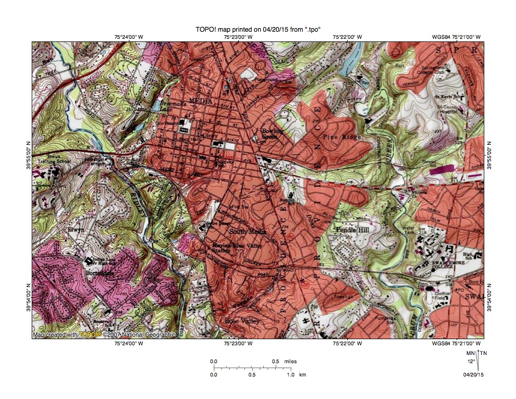
Figure 1: Crum Creek-Ridley Creek drainage divide area near Media. United States Geological Survey map digitally presented using National Geographic TOPO software.
Figure 1 illustrates the Crum Creek-Ridley Creek drainage divide area near Media. Ridley Creek flows from the northwest corner of figure 1 in a south-southeast direction to the south edge of figure 1 (west half). Crum Creek flows in a south direction across the east half of figure 1. Media is the town in the north center area of figure 1 and is located on the divide between Crum Creek and Ridley Creek. Note how Ridley and Crum Creek tributaries from the west are oriented in northeast directions and drain to Ridley and Crum Creeks as barbed tributaries. Also note how Ridley and Crum Creek tributaries from the east are oriented in southwest directions and how the northeast and southwest orientation of the Ridley and Crum Creek tributaries suggests a pattern of aligned or closely spaced and roughly parallel southwest oriented drainage routes.
The aligned drainage and barbed tributaries provide evidence of water flow routes that existed prior to headward erosion of the much deeper Ridley Creek and Crum Creek valleys. Evidence seen in figure 1 suggests multiple parallel and closely spaced southwest oriented flow routes crossed the region and were captured by headward erosion of the deeper Ridley Creek valley and subsequently by headward erosion of the deeper Crum Creek valley. These multiple and parallel former southwest oriented flow routes suggest massive and prolonged southwest oriented flood flow crossed the region at the time the deep Ridley Creek and Crum Creek valleys eroded headward into the region. The floodwater source cannot be determined from southeast Pennsylvania evidence, but may have been melt water from a continental ice sheet, although there may be a time paradox as previously published interpretations suggest southeast Pennsylvania region drainage networks were established prior to Pleistocene continental ice sheet development.

Leave a comment